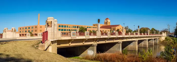
Virtual Reality Makes the Engineering Landscape Real
The stereoscopic 3D movie experience popularized by the movie “Avatar” is apparently not exhilarating enough for the American viewing public. Now an even more immersive and multi-sensory movie experience via Virtual Reality (VR) technology is on its way. Some predict that the most satisfying movie experience will be the one to be had at home, with the help of sophisticated VR headsets like the Oculus Rift, recently released in stores.

This trend shouldn’t surprise anyone. The quest for an ever more true-to-life experience, whether it is for the purpose of creating a virtual prototype or a more memorable day at the movies, is clear. Computer Aided Manufacturing (CAM), Design (CAD) and Engineering (CAE) are tools that find new applications daily and Cave Automatic Virtual Environment (CAVE) laboratories continue to spring up like mushrooms on college campuses across the nation. Virtual reality engineering, with its ability to combine an advanced software platform with high definition visualization technology, looms large in our future.
How does Virtual Reality shape our engineering software?
What does Virtual Reality (VR) have in common with civil engineering? It turns out the similarities are many. Civil engineers need to review CAD drawings and paper plan sheets and visualize in their mind what their engineering project entails. They work with 3D elevation data to create terrain models that can be used in their engineering work, but generally only view the terrain using 2D contour lines. By blending together VR with civil engineering software, the engineer can enjoy a more immersive real-time experience, viewing and editing the engineering project in 3D space.
At CivilGEO we have combined VR with HEC-RAS in order to allow the engineer to perform flood modeling, develop bridge replacements, analyze dam failures, and create stream realignments within a VR framework of 3D visualization technology. It’s kind of like doing your engineering in a video game environment.
A Virtual GeoHECRAS Client Experience
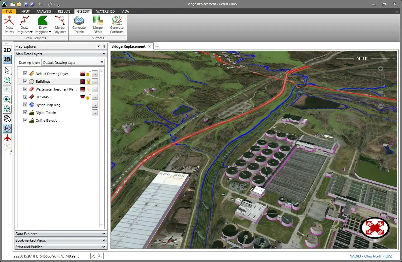
Recently I was leading a client through a bridge replacement project with our GeoHECRAS software. We began by pulling in a Google base map for the project area and setting the projection coordinate system that the project was to be georeferenced with. We imported an AutoCAD drawing file, along with a supportive ArcGIS shapefile from the local county GIS department containing building footprints. We loaded a LIDAR elevation data set, and then supplemented the channel geometry and bridge structure data with survey point data sets. As this data came in, the engineer could easily switch from a 2D to 3D viewing perspective to examine the data.
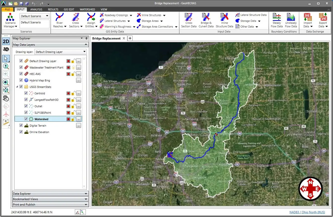
Next, we instructed GeoHECRAS to compute the associated drainage area for the bridge. Within minutes we had delineated the drainage area as 442 square miles and computed the 2 through 500-year design storm peak flows.
Next, the software automatically downloaded the FEMA flood map data, along with the river alignment, as GIS data.
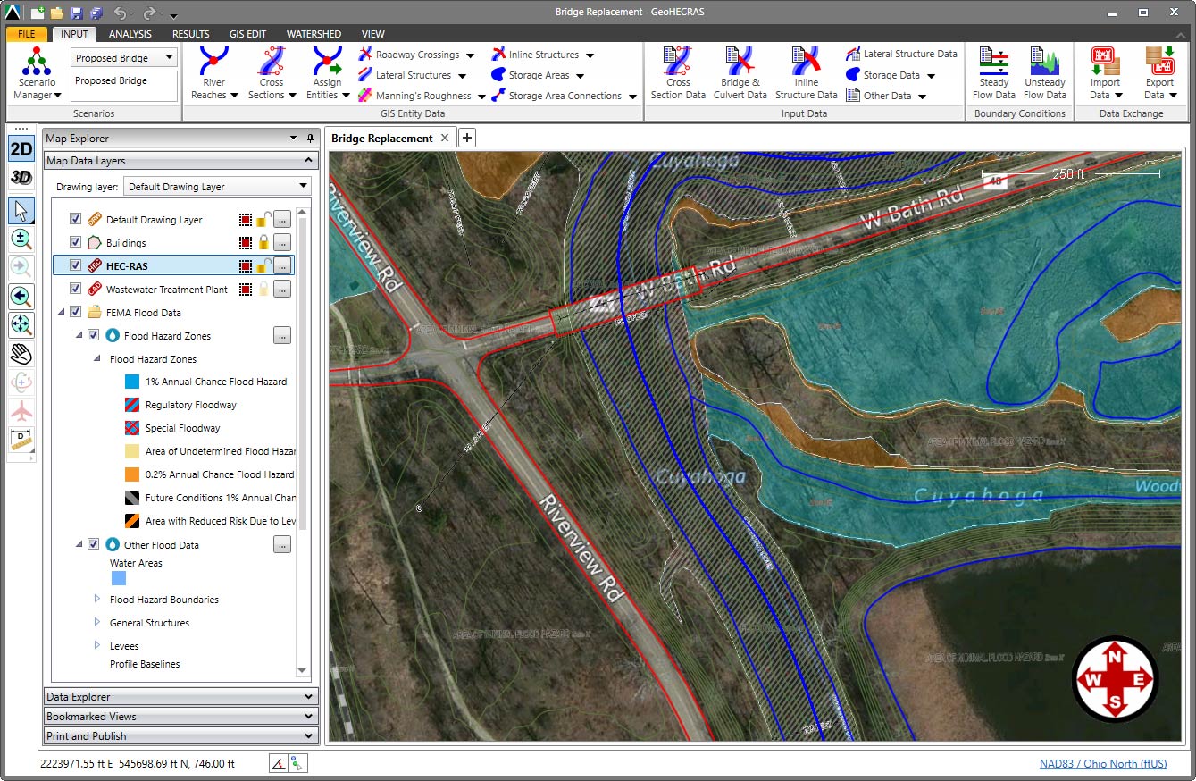
Using the FEMA river alignment, we assigned the HEC-RAS river reach and then had the software automatically extract cross sections downstream and upstream of the existing roadway crossing using the loaded LIDAR data. The software then supplemented the cross section channel geometry with the provided survey data. Using information from both the AutoCAD drawings and provided survey data, we defined the existing bridge geometry.
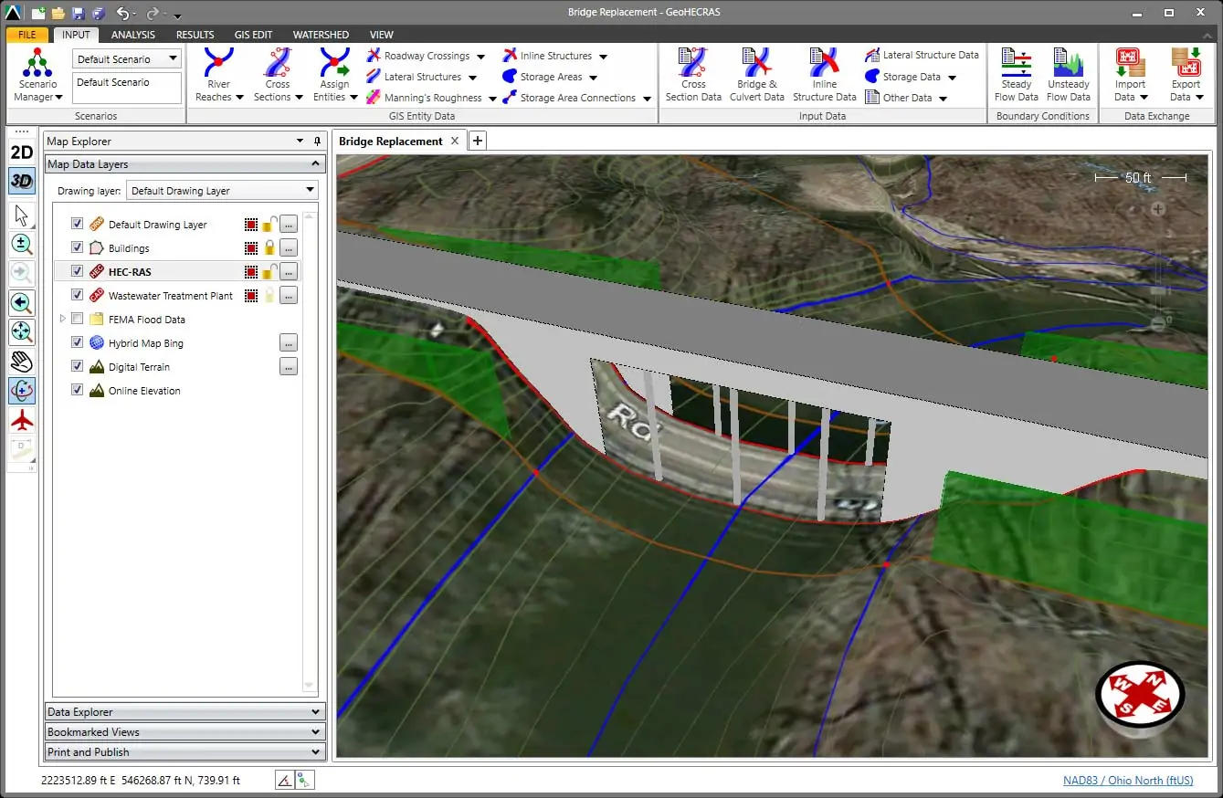
Having defined the flow conditions, GeoHECRAS performed the HEC-RAS analysis and generated the flood map; we were finished with the existing conditions model. This was all completed within the span of 15 minutes and all within a 3D virtual reality. The engineer was able to seamlessly shift from 2D and 3D viewing perspectives of the HEC-RAS model. He could rotate, pan, zoom and fly through the model to any vantage point to review cross sections, the bridge structure, pier locations, ineffective flow areas and more. We couldn’t exactly smell the earthiness of the bordering wetland or hear the hum of the adjacent expressway, but we nearly could.
Next up was to develop a replacement bridge for the roadway crossing. That was completed with two alternative designs, again all in the span of minutes.
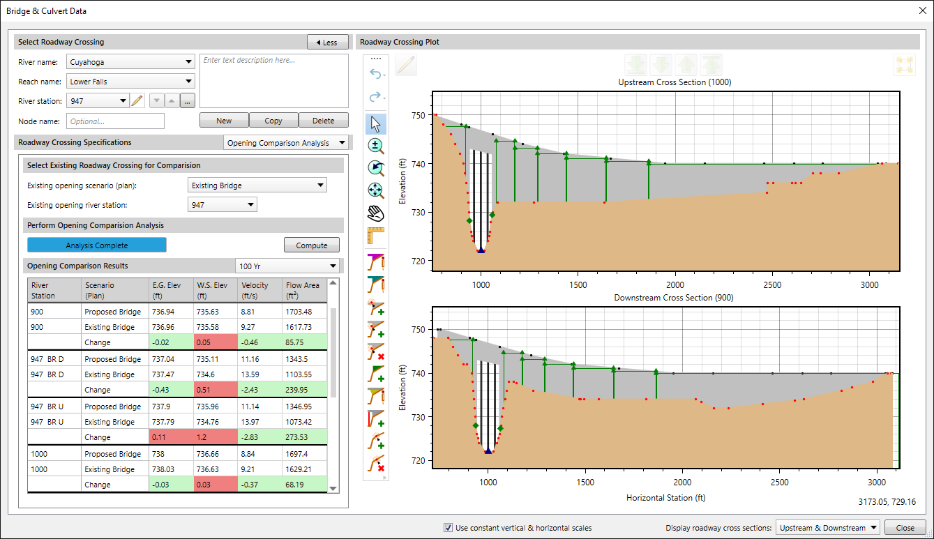
The client changed the parameters of the proposed bridge opening and instantly the bridge geometry changed to reflect the new inputs. He had a truly bird’s eye perspective with the tools of a world-class engineer at his fingertips. Welcome to the new world of VR civil engineering!
The Virtual Experience We Offer
GeoHECRAS allows you to interact with your HEC-RAS model, visualize the terrain, cross sections, roadway crossings, levees and other structures, all in high-resolution 3D virtual reality. You aren’t required to buy an Oculus Rift to use GeoHECRAS. But, modeling with our software offers its own unique virtual experience. We suggest you give it a try.