


The software is extremely user friendly…
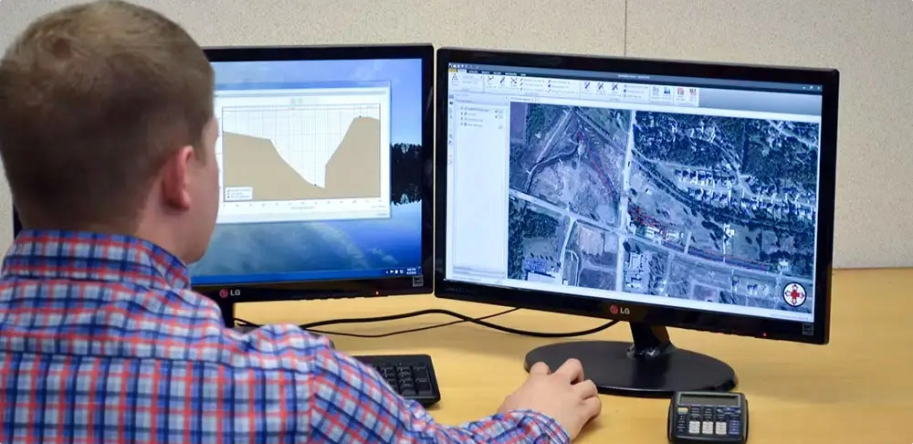
GeoHECRAS provides a lot of additional functionality, over and above just HEC‑RAS modeling. In fact, I find that I use the software quite a lot for watershed delineation mapping on drainage projects that we have. The ability to import topo and aerial maps is very useful. The software is extremely user friendly, and much better than the old “Windows style” HEC‑RAS software.
The ability to pull all my data into a single user interface and start to develop my project is a huge time saver. I can pull in the quad map and the FEMA flood map with GeoHECRAS’ built-in functionality by simply selecting the appropriate maps. Up until now we had to go to different sources and try to aggregate this information into our project. GeoHECRAS does this function with just a couple of mouse clicks.
Clearly, GeoHECRAS makes my HEC‑RAS work easier and more efficient.
Chris Gatling, P.E.
Project Engineer
Mickle Wagner Coleman Inc.
Fort Smith, AR
Project Engineer
Mickle Wagner Coleman Inc.
Fort Smith, AR

 Back
BackCivilGEO reviews
4.8/5.0 Rating, Over 230 Reviews

GeoHECRAS is recognized as the top Civil Engineering Design Software with an average of 4.8 out of 5.0 rating from over 230 real user reviews on G2.


Reach us on WhatsApp at


