FTN ASSOCIATES
Unmapped Tributaries in the Illinois River Watershed
GEOHECRAS CUSTOMER SUCCESS STORY
Floodplain analysis and creation of FEMA (Federal Emergency Management Agency) flood maps is routine work for FTN Associates Ltd. (FTN), a multi-disciplinary environmental consulting firm based in Little Rock, Arkansas. Founded by former USACE (United States Army Corps) engineers, the firm has developed expertise in NPDES permitting and wastewater management, hydrogeological studies and solid waste, among other areas. Floodplain delineation projects have always been core to the firm’s portfolio of projects.
Floodplain Delineation Projects at FTN are Core
Lee Beshoner, Project Engineer at FTN, explains that floodplain delineation projects generally fall into one of two sub-categories: projects are either detailed analyses of a few waterways or more general analyses of a greater number of streams or rivers. FTN is under contract with the State of Arkansas to delineate the state’s floodplains pursuant to the National Flood Insurance Program (NFIP). As part of this long-term contract, FTN recently tackled three unmapped community streams in the Illinois River Watershed of Northwest Arkansas.
Subdivision, Pasture and Extreme Terrain in the Illinois River Wastershed
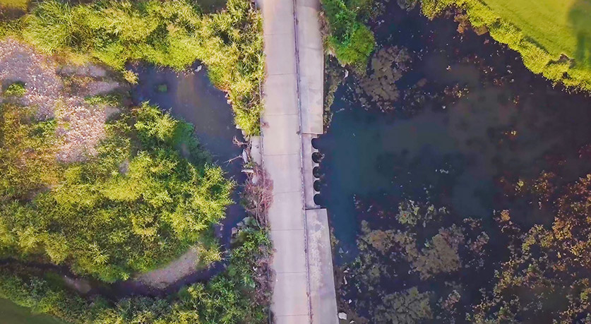
Beshoner explained that this set of tributaries in Northwest Arkansas had “a little bit of everything” in terms of types of land use. Pasture and rural lands transitioned to residential subdivisions before returning to undeveloped, open land uses, at which point the tributaries joined the Illinois River. To further complicate the analysis, these tributaries also had multiple structures in the stream channels—bridges, culverts and road crossings—especially in areas near residential subdivisions.
Creating digitized surface terrain in an extremely variable landscape where areas with flat terrain transitioned to steeper slopes was challenging. In undeveloped areas, building the model was straightforward; however, in zones abutting residential areas, the task became significantly more difficult.
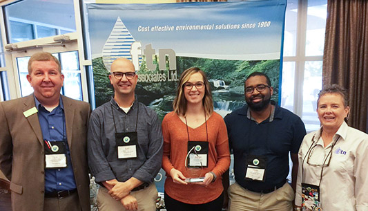
About FTN Associates Ltd.
FTN Associates Ltd. (FTN) is a multi-disciplinary environmental consulting firm based in Little Rock, Arkansas, serving their clients’ needs since 1981. The firm provides specialty services to private and governmental clients in Arkansas and throughout the nation. Founded by former USACE (United States Army Corps) engineers, the firm has developed expertise in NPDES permitting and wastewater management, hydrogeological studies, and solid waste, among other areas. Their customers benefit from the broad spectrum of expertise provided by FTN that includes unique problem-solving capabilities. Through their decades of experience with federal, state, and local regulatory agencies, clients receive reliable, cost-effective, and professional services. FTN provides clients practical solutions at minimum cost.
FTN Associates’ headquarters is in Little Rock, with branch offices in Fayetteville, AR, Baton Rouge, LA, and Chesterfield, MO.

GeoHECRAS Simplifies Model Development in Complex Terrain
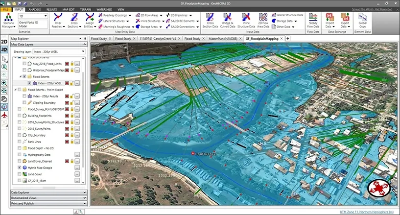
For stormwater calculations, FTN uses ArcGIS and USACE HEC-HMS, and then enters the digital terrain data into GeoHECRAS where stream centerlines, embankments, and other features are processed. Beshoner states that GeoHECRAS has definitely replaced much of FTN’s pre-processing software. Other than some preparatory work, the firm has discovered that nearly every aspect of model construction and analysis can be done in GeoHECRAS. The software lets the firm easily incorporate a variety of geospatial data files: survey data, channel data, bridge or culvert data and road data before running model computations. Prior to GeoHECRAS,Beshoner notes that his firm would have needed to rely on ESRI ArcGIS in addition to the USACE’s HEC-RAS and some additional output processing software to edit and run models.
Not the Way We Used to Do it: Model Modification in Real-Time
Prior to GeoHECRAS, Beshoner explains, changes to the model could only be made through a very iterative, time-consuming process that involved moving between different software applications. He explains that the streamlined user interface in GeoHECRAS makes it easy for the engineer to interact with the simulation graphically, modify cross-sections, and adjust other structural or geographic elements. The software automatically updates the model and visualizations in real-time, saving the firm a lot of time and effort. If FTN needs to animate a scenario, GeoHECRAS provides that capability.
The software has multiple tools available to present a story, easily generating visual results for each phase of a project: challenges, model results and possible solutions. These striking visualizations are appreciated by FTN’s clients and help to clarify specific project issues. The software has multiple tools available to present a story, easily generating visual results for each phase of a project: challenges, model results and possible solutions. These striking visualizations are appreciated by FTN’s clients and help to clarify specific project issues.

“We find GeoHECRAS helpful to incorporate survey data: channel information, bridge or culvert data, road data… It’s very easy to do that. We also like how we can see the floodway computations in GeoHECRAS. Seeing the computational results graphically plotted on the map in real-time is a big benefit.”
Maximizing the Power of GeoHECRAS: Template Creation, Process Standardization and More
The geospatial referencing capabilities of GeoHECRAS has been highly useful for FTN Associates to bring older models up to date. GeoHECRAS easily and accurately repositions these models on the map, a feature which allows engineers to quickly “resurrect” older simulations and quickly get up to speed and back to work. The software is also highly beneficial when it comes to modeling larger scale projects. FTN can create templates with GeoHECRAS to easily run 600 to 700 models for a watershed. With certain kinds of projects that FTN runs frequently, GeoHECRAS automatically knows what to look for and populates the data accordingly. The ability to standardize methodologies and categories of projects for recurring work has created significant time efficiencies and cost savings for FTN.
In many respects, CivilGEO software has been a “game changer” for the firm. Beshoner looks forward to trying out some of GeoHECRAS’s newer features, like the software’s “Google Street View”.
Products
Company
Customers
Support
Training
Contact Us
 1-800-301-02-955
 608-729-5100
(US and Canada)
 [email protected]
 +1 608-729-5100
–
–
–Tel:
CivilGEO India
Graphix Tower, A-13 A
3rd Floor, Sector 62
Noida, Uttar Pradesh 201309
IndiaTel:
1-800-301-02-955 or
+91 022-3831-8601
Copyright
Copyright © CivilGEO, Inc. All rights reserved. The CivilGEO logo, “GeoSTORM”, “GeoHECHMS”, “GeoHECRAS”, and “Ready To Engineer” are registered trademarks of CivilGEO,Inc.
All other brands, company names, product names or trademarks belong to their respective holders.

 Advanced engineering software that is “Ready to Engineer”. Get started today!


