


 Advanced engineering software that is “Ready to Engineer”. Get started today!

Reading Time: 3 Mins


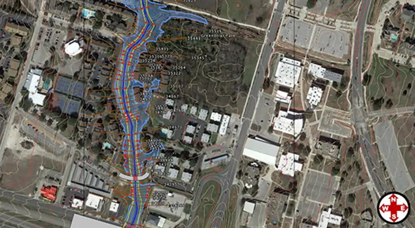
One of KPA Engineer’s recent contracts involved performing drainage assessment studies for several watersheds. The study area included 73 square miles of drainage area, parts of which were located in the City of Temple, Texas, extraterritorial areas, and within the County of Bell, Texas. Goals of the studies included generating hydrologic and hydraulic models, mapping existing and projected land uses in the region, as well as developing recommendations for the siting of floodwater detention ponds. Another objective of the project was to update regional National Flood Insurance Program (NFIP) Flood Insurance Rate Maps.
Building a Model from the Ground Up
As with many projects of this scale and scope, building several functioning hydraulic models for the watersheds presented a significant challenge. GeoHECRAS made it convenient to import a range of data files, from LIDAR data sets to terrain DEMs. Once data sets and model elements—cross-sections, detention ponds, and hydraulic structures—were added, KPA found it easy to modify the terrain surfaces and define the model elements.
About KPA Engineers
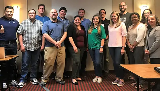
Kasberg, Patrick & Associates (KPA) is a civil engineering firm with multiple offices in Texas. Established in 1983, the company has a strong project portfolio in transportation, water supply, water-treatment, wastewater collection, wastewater treatment, railroad layout and stormwater management. The firm is also involved in floodplain analysis, water quality, wetland restoration and mitigation, and watershed planning.
KPA found GeoHECRAS to be highly effective for all phases of the project: pre-processing, model construction, analysis and post-processing. Prior to using GeoHECRAS, KPA engineers would have had to switch back and forth between various CAD and GIS programs and the U.S. Army Corps of Engineers (USACOE) HEC-RAS software in an iterative, time-consuming process.

“We found the use of GeoHECRAS effective at all phases of the project: pre-processing, model construction, analysis and post-processing.”
Easy to Import Data and Integrate Structural Elements
Project Manager Michael Newman notes that GeoHECRAS added functionality and efficiencies that the firm could not achieve with other software. GeoHECRAS makes it straightforward to create and edit cross sections, terrain models, DEM files, creek banks, contours, ineffective flow areas, bridges, flow data and virtually any structural elements encountered in and near waterways. The hydraulic model cross section geometries and ground point reductions were easily implemented. GeoHECRAS proved nearly indispensable at several points of the project and created significant efficiencies throughout.
GeoHECRAS provided KPA with the tools needed to achieve maximum productivity in several areas. The software’s extensive knowledge base helped the assigned team of 3 to 5 modelers standardize strategies, share information and replicate modeling protocols. Maintaining consistent modeling methodologies across all watersheds and throughout the project was favorably achieved with use of GeoHECRAS’ hydraulic application. Finally, GeoHECRAS exceeded KPA’s expectations in terms of assembling the many analyses and outputs into a final product, creating effective visualizations and exporting electronic files for submittal to various stakeholders and regulators.
CivilGEO reviews
4.8/5.0 Rating, Over 230 Reviews

GeoHECRAS is recognized as the top Civil Engineering Design Software with an average of 4.8 out of 5.0 rating from over 230 real user reviews on G2.


